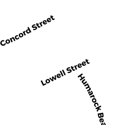
117 HUMAROCK BEACH
Owner Information
DORRER LINDA M, DAVID C TR &
35 SUMMIT DRIVE
E BRIDGEWATER, MA 02333


Property Details
117 HUMAROCK BEACH is classified as a Single Family Residential (Conventional).
The primary structure on this property was built in 1880. There are 1,812ft2 of built area within this property. There is 1,812ft2 of residential/living space within this property. This property is listed as having 9 rooms.
117 HUMAROCK BEACH is valued at $571,900. The land is valued at $445,100 and the structures are valued at $122,800. There is an additional valuation of $4,000 on this property.
The most recent deed for 117 HUMAROCK BEACH is recorded at the local registrar in Book 55729, Page 331. 117 HUMAROCK BEACH was last sold on Monday, September 27, 2021 for $1.
Assessment data from fiscal year 2022.
Flood Data
This property has multiple flood prone designations.
| Zone | Description | BFE | Area |
|---|---|---|---|
| AE | within floodplain | 13 | 0.19 (78.25%) |
| VE | coastal flooding with wave action | 16 | 0.05 (21.75%) |
This information is sourced from the FEMA National Flood Hazard Layer. See our full disclamer.
Broadband Internet Providers
| Provider | Type | Bandwidth (mbps) | |
|---|---|---|---|
| Viasat Inc | Satellite | 100 | 3 |
| HughesNet | Satellite | 25 | 3 |
| GCI Communication Corp. | Satellite | 0 | 0 |
| Comcast | Cable | 1000 | 35 |
| Verizon New England Inc. | Fiber | 940 | 880 |
| Verizon New England Inc. | DSL | 5 | 0 |
| VSAT Systems, LLC. | Satellite | 2 | 1 |
Broadband service provider data from December 2020.